Salalah is a coastal city, laying on the Indian Ocean. It is a unique place in the Arabian Peninsula. On the northern side, it has mountain range, with greenery and lakes (in Khareef Season). On the southern side, it has lovely beaches, which are sunny from September to June every year. Salalah is a city spread between these mountainous regions and the Indian Ocean. It is located in Dhofar Governorate.
Salalah is one of the largest sea ports in the gulf region.
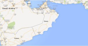
Salalah Map, Source: Google Map
Salalah is located on the Southern part of Oman, around 1000 kms away from Muscat. It is accessible from Muscat via road, air or sea.